Embark on a journey through time with our Great Lakes 13 Colonies map, where the past comes alive before your eyes. Dive into the heart of colonial America, where the Great Lakes played a pivotal role in shaping the destiny of a nation.
From the vibrant Native American settlements to the clash of European powers, from the battles of the American Revolution to the westward expansion, this map unveils the rich tapestry of events that unfolded in this iconic region.
Historical Context
The Great Lakes region played a pivotal role in the colonial era of North America. Its vast waterways provided vital transportation routes for fur traders, missionaries, and settlers, connecting the interior of the continent to the Atlantic coast.
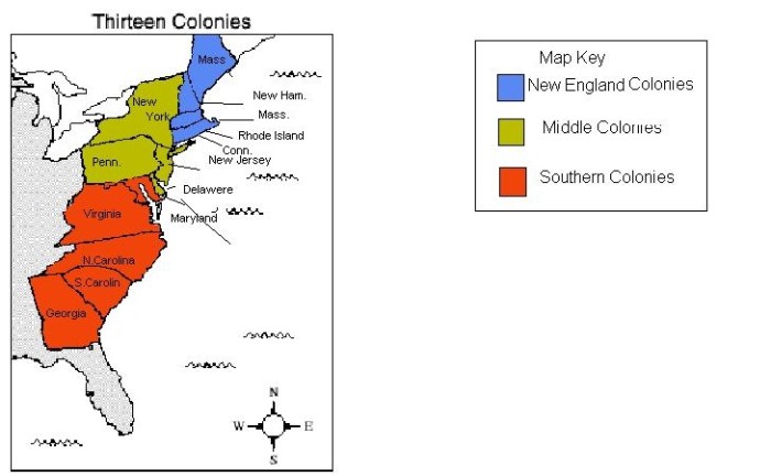
The 13 colonies, established along the Atlantic seaboard, had varying degrees of involvement with the Great Lakes region. Some, like New York and Pennsylvania, claimed territory that extended into the Great Lakes basin, while others, like Massachusetts and Virginia, had more limited connections.
Role of Fur Trade
The fur trade was a major economic driver in the Great Lakes region during the colonial era. French and British traders established trading posts throughout the region, exchanging European goods for beaver pelts and other valuable furs.
- The fur trade led to increased exploration and settlement of the Great Lakes region.
- It also brought European diseases to Native American populations, devastating their communities.
Influence of Native Americans
Native American tribes played a significant role in shaping the history of the Great Lakes region during the colonial era. They served as guides and interpreters for European explorers and traders, and they often resisted European encroachment on their traditional lands.
- The Iroquois Confederacy, a powerful alliance of six Native American nations, controlled much of the Great Lakes region during the colonial era.
- Native American tribes often allied with European powers to gain advantages in trade and warfare.
Geographical Features
The Great Lakes region is defined by its vast freshwater resources and sprawling forests. These geographical features have played a pivotal role in shaping the region’s history and continue to influence its present-day character.
Lakes
The Great Lakes, consisting of Lake Superior, Lake Michigan, Lake Huron, Lake Erie, and Lake Ontario, dominate the region’s landscape. These massive freshwater bodies provide a vital transportation network, connecting the region to the Atlantic Ocean via the St. Lawrence River.
The lakes also support a thriving fishing industry and offer recreational opportunities for millions of visitors.
Rivers
Numerous rivers flow through the Great Lakes region, including the Mississippi River, the Ohio River, and the St. Lawrence River. These rivers have been essential for transportation, trade, and settlement. They also provide water for irrigation, hydropower, and industry.
Forests
The Great Lakes region is home to vast forests, primarily consisting of deciduous trees such as oak, maple, and beech. These forests have provided timber for building and industry, as well as sustenance for Native American tribes and early settlers.
The Great Lakes were a vital transportation route for the 13 colonies. The city of Erie, Pennsylvania, was a major port on the Great Lakes, and it was the site of a landmark case in 1898 called City of Erie v.
Pap’s A.M.E. Church . This case established the principle of eminent domain, which allows the government to take private property for public use. The Great Lakes continue to be an important part of the economy and transportation system of the United States.
The forests also play a crucial role in maintaining the region’s biodiversity and water quality.
Native American Presence

The Great Lakes region was home to various Native American tribes before European colonization. The largest and most influential tribes included the Iroquois Confederacy, the Ojibwe, the Potawatomi, and the Huron. These tribes had distinct cultures, languages, and political systems.Their
interactions with European settlers were complex and often fraught with conflict. Initially, Native Americans traded with Europeans for goods such as metal tools, firearms, and cloth. However, as European settlement expanded, conflicts over land and resources escalated. Native Americans were forced to cede vast territories, and their traditional way of life was disrupted.
Iroquois Confederacy
The Iroquois Confederacy, also known as the Haudenosaunee, was a powerful alliance of five (later six) Native American nations: the Mohawk, Oneida, Onondaga, Cayuga, Seneca, and Tuscarora. They occupied a vast territory in present-day New York and Pennsylvania. The Iroquois were skilled farmers, hunters, and warriors.
They developed a sophisticated political system based on consensus and representative government.
Ojibwe
The Ojibwe, also known as the Chippewa, were a large and widespread tribe that inhabited the northern Great Lakes region. They were skilled fishermen, hunters, and gatherers. The Ojibwe had a rich oral tradition and were known for their storytelling and birchbark canoes.
Potawatomi, Great lakes 13 colonies map
The Potawatomi were a tribe that lived in the southern Great Lakes region. They were closely related to the Ojibwe and shared many cultural similarities. The Potawatomi were skilled farmers and hunters. They also played an important role in the fur trade.
Huron
The Huron were a tribe that lived in the central Great Lakes region. They were skilled farmers and fishermen. The Huron were also known for their longhouses, which were large, communal dwellings.The Native American tribes of the Great Lakes region played a vital role in the history of the region.
Their interactions with European settlers had a profound impact on both cultures.
European Exploration and Settlement
The European exploration of the Great Lakes region began in the 16th century, with French explorers leading the way. The first European to reach the Great Lakes was Étienne Brûlé, who explored Lake Huron in 1615. Over the next few decades, other French explorers, including Samuel de Champlain and Louis Jolliet, explored the Great Lakes and established fur trading posts in the region.
The French were not the only Europeans interested in the Great Lakes region. The British also established fur trading posts in the region, and the two powers competed for control of the fur trade. The competition between the French and British eventually led to the French and Indian War, which was fought from 1754 to 1763. The British won the war, and as a result, they gained control of the Great Lakes region.
Fur Trading Posts
The fur trade was the driving force behind European exploration and settlement of the Great Lakes region. Fur traders established posts throughout the region, where they traded with Native Americans for furs. The most important fur trading posts in the Great Lakes region were Michilimackinac, Detroit, and Fort Niagara.
The fur trade had a significant impact on the Great Lakes region. It led to the introduction of European goods into the region, and it also led to the displacement of Native Americans from their traditional lands. The fur trade also played a role in the outbreak of the French and Indian War.
The Role of the French and British
The French and British played a major role in the history of the Great Lakes region. The French were the first Europeans to explore the region, and they established fur trading posts throughout the area. The British eventually gained control of the region, and they played a major role in the development of the Great Lakes region.
The French and British had different approaches to colonization. The French were more interested in fur trading, while the British were more interested in settlement. This difference in approach led to different outcomes in the two regions. The French established a number of fur trading posts in the Great Lakes region, but they did not establish any permanent settlements.
The British, on the other hand, established a number of permanent settlements in the Great Lakes region, and they eventually gained control of the region.
Territorial Disputes: Great Lakes 13 Colonies Map

The Great Lakes region was a major area of conflict between France and Great Britain during the 17th and 18th centuries. Both countries claimed vast territories in the region, and their rivalry led to a series of wars, including the French and Indian War.
The French based their claims on the explorations of Jacques Marquette and Louis Jolliet, who explored the Mississippi River in 1673. The British, on the other hand, based their claims on the explorations of John Cabot, who explored the North American coast in 1497.
French and Indian War
The French and Indian War (1754-1763) was a major conflict between France and Great Britain for control of North America. The war began in the Ohio Valley, where both countries were competing for control of the fur trade. The war eventually spread to other parts of North America, including the Great Lakes region.
The French and Indian War ended with the Treaty of Paris in 1763. The treaty gave Great Britain control of all of French territory in North America east of the Mississippi River. This included the Great Lakes region.
American Revolution
The Great Lakes region played a significant role in the American Revolution. The region served as a crucial battleground, with control of the lakes being essential for both the British and American forces.
One of the most significant battles of the war, the Battle of Saratoga, took place in the Great Lakes region. The American victory at Saratoga was a turning point in the war, convincing France to join the American cause and providing the Continental Army with much-needed supplies and support.
Treaty of Paris
The Treaty of Paris, which ended the American Revolution, recognized the independence of the United States and established the Great Lakes as the boundary between the United States and British Canada.
Northwest Territory

After the American Revolution, the vast region northwest of the Ohio River and east of the Mississippi River was known as the Northwest Territory. The Treaty of Paris in 1783 established the United States’ claim to this territory, which encompassed present-day Ohio, Indiana, Illinois, Michigan, Wisconsin, and part of Minnesota.The
Northwest Ordinance of 1787 was a significant piece of legislation that governed the settlement and development of the Northwest Territory. The ordinance established a process for creating new states within the territory, guaranteed religious freedom, and prohibited slavery. It also established a system of public education and set aside land for public use, including schools and universities.
The Northwest Ordinance had a profound impact on the region, shaping its political, social, and economic development.
Provisions of the Northwest Ordinance
- Established a process for creating new states within the territory
- Guaranteed religious freedom
- Prohibited slavery
- Established a system of public education
- Set aside land for public use, including schools and universities
Impact of the Northwest Ordinance
- Shaped the political, social, and economic development of the Northwest Territory
- Contributed to the growth and prosperity of the region
- Laid the foundation for the future states of Ohio, Indiana, Illinois, Michigan, Wisconsin, and Minnesota
Economic Development
The 19th century witnessed a surge of economic growth in the Great Lakes region, driven by the Erie Canal, railroads, and the lumber industry.The Erie Canal, completed in 1825, connected the Great Lakes to the Atlantic Ocean, creating a vital waterway for trade and transportation.
It enabled the transport of agricultural products, manufactured goods, and raw materials between the Midwest and the East Coast, boosting economic development in the region.Railroads also played a significant role in the economic expansion of the Great Lakes region. The construction of rail lines facilitated the transportation of goods and people, opening up new markets and connecting remote areas to major urban centers.The
lumber industry flourished in the Great Lakes region, with vast forests providing an abundance of timber for construction, shipbuilding, and other industries. The region’s extensive waterways allowed for efficient transportation of logs and lumber, contributing significantly to the local economy.
Immigration and Settlement
The Great Lakes region witnessed significant immigration and settlement patterns, influenced by both European and Asian immigrants. This influx of diverse populations had a profound impact on the region’s cultural and economic landscape.
In the 19th century, European immigrants from countries such as Germany, Ireland, and Sweden arrived in large numbers, seeking economic opportunities and escaping political turmoil in their homelands. They settled in cities and established ethnic enclaves, contributing to the region’s urban growth and industrial development.
Asian Immigration
In the late 19th and early 20th centuries, Asian immigrants, primarily from China and Japan, also arrived in the Great Lakes region. They worked in various industries, including agriculture, mining, and manufacturing, and contributed to the region’s economic expansion.
Industrialization and Urbanization

The late 19th and early 20th centuries witnessed a period of rapid industrialization and urbanization in the Great Lakes region. This transformation was driven by the region’s rich natural resources, including iron ore, coal, and timber, as well as its strategic location on the Great Lakes waterways.
The rise of cities like Chicago, Detroit, and Cleveland was fueled by the growth of heavy industries such as steel production, automobile manufacturing, and shipbuilding. These industries attracted a massive influx of workers, leading to the expansion of cities and the development of urban centers.
Chicago
- Emerged as a major transportation hub and meatpacking center.
- Home to the Union Stock Yards, the largest livestock market in the world.
- Rapid population growth, reaching over 1 million by the early 20th century.
Detroit
- Became the global center of the automobile industry, earning the nickname “Motor City.”
- Home to the Ford Motor Company and General Motors.
- Experienced a surge in population, largely due to the influx of workers for the auto industry.
Cleveland
- Developed into a major iron and steel production center.
- Home to the U.S. Steel Corporation, the world’s largest steel producer.
- Became a significant industrial and economic hub in the region.
Environmental Challenges
The Great Lakes region faces several environmental challenges, including pollution, climate change, and invasive species.
Pollution from industrial activities, agricultural runoff, and urban wastewater has degraded the water quality of the Great Lakes. This pollution has caused algal blooms, fish kills, and beach closures.
Climate change is also affecting the Great Lakes region. The region is experiencing warmer temperatures, more extreme weather events, and rising lake levels. These changes are harming fish and wildlife, damaging infrastructure, and eroding shorelines.
Invasive Species
Invasive species are non-native species that have been introduced to the Great Lakes region and have become a threat to native ecosystems. Invasive species can outcompete native species for food and habitat, and they can also spread diseases and parasites.
- Zebra mussels are an invasive species that has colonized the Great Lakes and has caused significant ecological and economic damage.
- Sea lampreys are another invasive species that has harmed the Great Lakes fishery.
- Round gobies are a small fish that has invaded the Great Lakes and has become a food source for larger fish, such as walleye and bass.
FAQ Summary
Where can I find more information about the Great Lakes region during the colonial era?
Our map includes links to historical resources, articles, and interactive timelines.
How did the Native American tribes interact with European settlers?
The map highlights areas of cooperation and conflict between Native American tribes and European powers.